RESI
River Ecosystem Service Index
ANALYSIS AND ASSESSMENT OF ECOSYSTEM SERVICES IN RIVER LANDSCAPES
In Central Europe, rivers and their floodplains are intensely used nowadays for purposes such as hydroelectric power generation, shipping, agriculture and forestry, roads, railways and industrial areas, or for various recreational activities. Most rivers have been channelized or impounded for these purposes, and floodplains separated from them by the construction of dykes. At the same time, the remaining natural river sections and functional floodplains have been recognised to be absolutely essential to mitigate the epic floods which now occasionally occur due to climate change. Also, intact river-floodplain corridors are needed as refuges for biodiversity, since river corridors represent a valuable green infrastructure network within the vast agricultural and urban areas with low habitat value. As a consequence, many conflicts regarding the use of rivers and floodplains have arisen. Mitigation strategies are hampered by the fact that the competing claims from various interest groups are administered by different technical authorities at several political levels following various legal frameworks, for example the EU Water Framework Directive (WFD), the EU Flood Risk Management Directive (FRMD) and the EU Natura 2000 Directive. These sectoral approaches hinder mutual consulting and the development of integrated planning approaches, which prevents the identification of ways to optimise synergies and minimise negative side effects in river and floodplain management.
GOALS
The joint research project RESI aims to improve the current basis for decision-making by developing the so-called “River Ecosystem Services Index” (RESI). The RESI project thus aims at complementing the current state-based and sectoral assessment methods by a functional assessment based on the quantification of the various ecosystem services provided by river and floodplain areas. In order to achieve this, the capacities for ecosystem service supply as well as the actual flow of currently used ecosystem services are assessed for five exemplary river sections in Germany. The „River Ecosystem Services Index“ (RESI) will then serve as a tool to evaluate several development scenarios for water management, environmental planning and nature conservation. RESI will thus represent an integrated ecological-economic platform for the development of a harmonised cross-sectoral management of river corridors. By using RESI, management scenarios can thus be optimised in a transparent manner by maximising synergies among the multiple human uses of river landscapes.
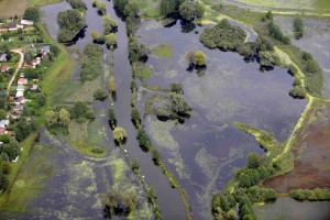
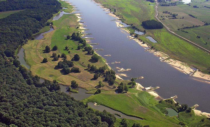
Flood on the river Spree in 2010
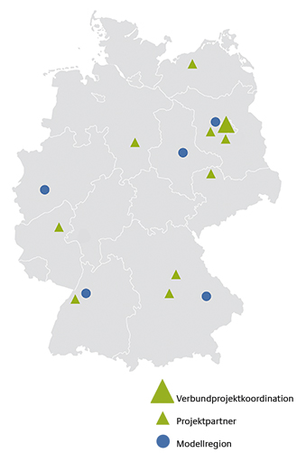
MODEL REGIONS
- Bavarian Danube between Neuburg and Deggendorf
- Upper Rhine river between Basle and Mainz
- Middle Elbe river between Torgau and Magdeburg
- Havel-Spree region
- Wupper catchment
Key messages
- The River Ecosystem Service Index (RESI) complements the current state-based assessment methods by a functional assessment based on ecosystem services (ESS).
- The RESI treats rivers and floodplains in a consistent manner and uses an integrative approach which visualises provisioning, regulating, and cultural ESS. This enables the RESI to take an intersectoral view and to compare management options in a transparent manner.
- The methods developed to record and assess the selected ESS were summarised in indicator fact sheets which show how various monitoring data can be used and prepared in a targeted manner for decision-making processes.
- The RESI provides interfaces to complement existing planning tools and creates a communication basis for solving target conflicts in decision-making processes.
- A survey performed among practitioners shows that they appreciate the added value of the RESI approach, especially as regards interdisciplinary coordination and public outreach.
Further Information
Kontakt
-
IGB - Leibniz-Institut für Gewässerökologie und Binnenfischerei
Abteilung Ökosystemforschung
PD Dr. Martin Pusch
T: +49 30 64181 685, -681
M: pusch@igb-berlin.de -
Simone Beichler
T: +49 30 64181 759
M: beichler@igb-berlin.de
Projektpartner
- IGB – Leibniz-Institut für Gewässerökologie und Binnenfischerei
- biota – Institut für ökologische Forschung und Planung GmbH
- Bundesanstalt für Gewässerkunde (BfG)
- DHI-WASY GmbH
- Helmholtz-Zentrum für Umweltforschung GmbH – UFZ
- Karlsruher Institut für Technologie Auen-Institut
- Katholische Universität Eichstätt-Ingolstadt Aueninstitut Neuburg
- Leibniz-Universität Hannover
- ÖKON Gesellschaft für Landschaftsökologie Gewässerbiologie und Umweltplanung mbH
- Technische Universität Berlin


 Deutsch

