Deutsch

Regional Water Resources Management for Sustainable Protection of Waters in Germany
PhosWaM
Phosphorus from source to sea – Integrated phosphorus and water resources management for sustainable water protection
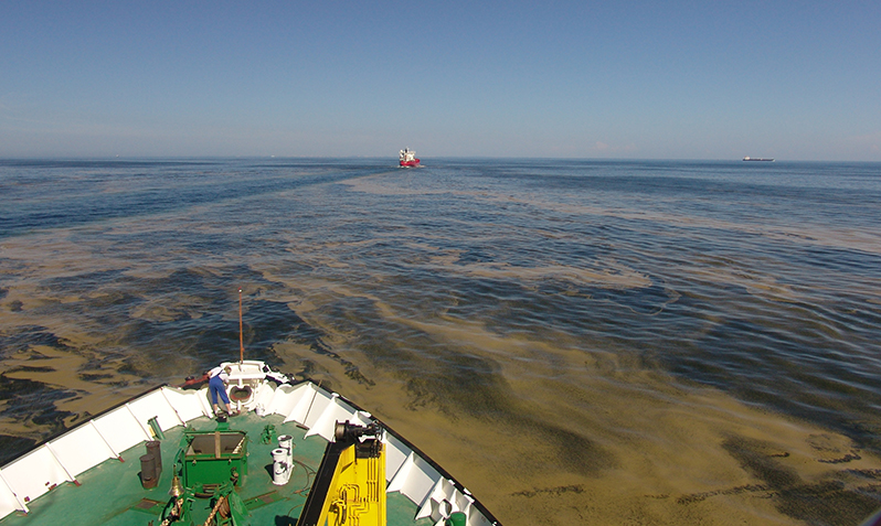
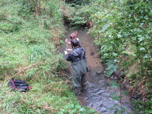
Credit: Bernd Sadkowiak, Leibniz-Institut für Ostseeforschung Warnemünde
Reducing critical levels of phosphorus in aquatic environtments
Next to nitrogen, phosphorus (P) is one of the essential nutrients for aquatic and terrestrial plants. While many aquatic ecosystems have a surplus of phosphorus (here and forthwith meaning ‘total phosphorus’) which leads to eutrophication, land used for agriculture is often phosphorus-deficient due to the extraction of biomass. As a result, farmers use phosphate as fertiliser on their land to promote plant growth. Not just agriculture, but industrial and sewage treatment plants also release phosphorus compounds into the environment. Via various routes – such as lakes, rivers and estuaries – a large percentage of these compounds reach the sea. Large amounts of phosphorus pose a significant problem for aquatic ecosystems. In aquatic environments, an over-abundance of nutrients leads to the excessive growth of phytoplankton and other aquatic plants. This leads to turbid water, toxic algal blooms, oxygen deficiency and a loss of biodiversity. The goal of the researchers and practice partners involved in the joint project PhosWaM is to identify emission sources and to evolve effective measures to reduce the P-levels in aquatic environments.
Goals
The project’s overarching goal is to enlarge the knowledge base with regard to the sources, transport routes and transformation processes of phosphorus compounds in waterways by studying processes and making use of models. With the help of the results of these studies, supplemented by the results of studies of measures such as controlled drainage, filter systems for small sewage treatment plants, and the opening of piped watercourses, proposals are to be drawn up for optimising the monitoring plans and action programmes to fulfil the requirements of the EC Water Framework Directive (WFD) and the EC Marine Strategy Framework Directive (MSFD).
Credit: Monika Nausch, Leibniz-Institut für Ostseeforschung Warnemünde
Other project goals:
- Quantify emission sources such as drainage-, groundwater- and erosion paths as well as small sewage treatment plants with the help of modelling
- Model the impact of measures and altered hydrological conditions on phosphorus losses
- For various arable crops, assess the risk of agricultural phosphorus losses into water bodies by means of field trials and by using a phosphorus index
- Examine how various phosphorus fractions contribute to water pollution and how they change along the course of a waterway
- Develop and test measures to reduce phosphorus inputs and/or control phosphorus retention
- Develop an overall concept for improving phosphorus retention
- Develop recommendations for regional and national planning authorities
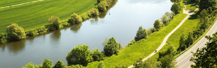
Model region
The studies focus on the catchment area of the river Warnow, the river Unterwarnow and the adjacent coastal waters of the Baltic Sea. At 3,324 km², the Warnow and Unterwarnow are the second largest German catchment area that drains into the Baltic Sea. The region is mainly agricultural, and its hydrologic balance has been strongly altered by anthropogenic influences.
Selected interim results
In order to supplement the selective sampling and be able to calculate scenarios (P reduction measures, climate change), an ecohydrological model was drawn up for the river Warnow (SWAT – Soil and Water Assessment Tool). By modifying the model (taking into account P in drainage systems) it was possible to precisely map the specific pathways (surface runoff, drainage systems, groundwater, and sewage treatment plants) of P loads in their seasonal dynamics at the sub-catchment scale over a period of 20 years. At the same time, a regional Baltic Sea ecosystem model (ERGOM – Ecological ReGional Ocean Model) was drawn up and expanded. By coupling the models, P transport and P turnover from simulated riverine inputs of the Warnow can be tracked into the Baltic Sea. In addition, a P index for the catchment area is currently being modified and used. This index enables practitioners on site to assess the risk of diffuse P losses and to evaluate the effectiveness of measures. To complement this, fertilisation tests are being carried out to determine the impact of e.g. digestates on diffuse P losses.
Key messages
- PhosWaM investigated in a complex matter P-transports, transformations and retention of all P-fractions in the whole catchment area of the river Warnow from the spring to the Baltic Sea.
- Among others, concrete proposals for efficient fertilization using a P-index, the installation of P-filters in drainage outlets, the reduction of P-input from small municipal sewage treatment plants or the optimization of future deepening’s in the Rostock harbor elaborated. All measures are summarized in a catalog.
- Results are used for the implementation of measures to combat eutrophication in rivers, lakes estuaries and the Baltic Sea, required by the Water Framework directive, the Marine Strategy Framework Directive and the Baltic Sea Action Plan of HELCOM.
- Results will be incorporated into the design of future monitoring programs and the next management plan for the river Warnow in 2020/2021.
Further Information
Kontakt
-
Leibniz-Institut für Ostseeforschung Warnemünde
Dr. Günther Nausch
T: +49 381-5197332
M: guenther.nausch@io-warnemuende.de -
Dr. Friederike Kunz
T: +49 381-5197109
M: friederike.kunz@io-warnemuende.de