Deutsch

Regional Water Resources Management for Sustainable Protection of Waters in Germany
RiverView
River status monitoring and management
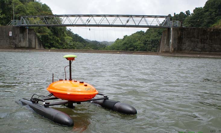
REMOTE-CONTROLLED BOAT MONITORS STREAMS AND RIVERS
Extreme events, disasters, and dynamic changes in rivers as a result of urbanisation, intensive farming, multiple pollutant entry and climate change – the challenges water management faces are manifold. But these phenomena and changes all have one thing in common: They generate a need for river data which has high temporal and spatial resolution and is available at short notice. These data are relevant for describing and evaluating river dynamics for regional water resources management and for identifying sustainable measures.
With the joint project RiverView, a holistic approach for surface water status monitoring and management will be developed for the first time. This will allow the systematic survey of synoptic visual, hydromorphological, hydrochemical and hydrophysical surface water data. Within the framework of the joint project, a carrier boat will be further developed which is remote-controlled and can travel up and down small- and medium-sized rivers. This allows synoptic longitudinal water monitoring to be carried out and interdisciplinary processes in the river’s longitudinal section to be linked to one another. However, the system is suitable not only for standard monitoring, but also to collect data during and after flood events or for the remote impact analysis of water pollution, e.g. after the inflow of pollutants and after accidents or disasters.
GOALS
RiverView aims to develop new and innovative solutions, including extensive data collection,
-visualisation and -analysis (above and below water) to specifically support water managers and specialised planners in fulfilling their many tasks. The goal is to facilitate the implementation of sustainable measures when designing water bodies and to get the general public more involved. The joint project focuses on the following priorities:
- Collecting spatial data in selected surface waters with support of boat-based camera images
- Analysing and linking that data as laid down by the EU Water Framework Directive, as well as preparing the data and making it accessible to the general public
- Enlarging the number of methods to secure evidence in order to study the impact of hydraulic engineering measures
- Implementing timely and broad monitoring of various surface water parameters after extreme events, accidents and incidents
- Recording and analysing the impact of changes in land use, flood events and climate change at and in rivers
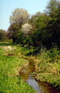
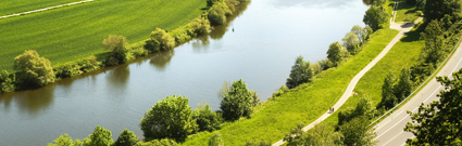
Renaturated Rur in Linnich Körrenzig
MODEL REGIONS
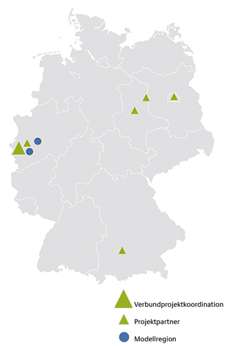
Selected rivers of the Eifel-Rur Water Association (Roer, Inde, Wurm) and the rivers of the Emschergenossenschaft / Lippeverband (Lippe, Emscher and their tributaries) in North Rhine-Westphalia will be monitored by boat. There are also plans to monitor other model regions by boat in the context of a collaboration with the joint project BOOT-Monitoring.
Key messages
- In the RiverView project, integrated and accurately georeferenced river structure, water quality and image data are collected using a mobile carrier platform equipped with modular sensor technology.
- Representative and high-resolution data for water management planning and monitoring processes are available for practical application (e.g. industrial and municipal discharges).
- By using an autopilot, recordings can be made at different points in time on exactly the same measuring section, so that river development processes can be understood and documented.
- Further processing of 360°-above- and underwater images to a panoramic pictorial world with virtual reality elements is available – just like 3D-models as tools for communicating hydraulic engineering measures.
Further Information
Kontakt
-
Forschungsinstitut für Wasser- und Abfallwirtschaft an der RWTH Aachen (FiW) e. V.
David Wehmeyer
T: +49 241 80 2 28 25
M: wehmeyer@fiw.rwth-aachen.de