Deutsch

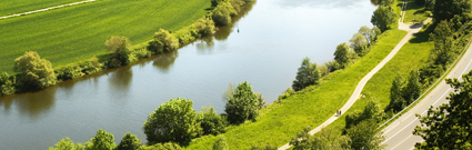
Regional Water Resources Management for Sustainable Protection of Waters in Germany
Model Regions
All ReWaM projects address the diverse challenges of regional water resources management in model regions. The model regions and study sites are located throughout the entire Federal Republic of Germany. In total, the joint projects are studying watercourses, lakes, reservoirs and groundwater bodies in 13 federal states. This will allow the transfer of the research findings not only to other regions in Germany, but also to other European countries.
| BOOT-Monitoring | The joint project will study two model regions: The ‚Freiberger Mulde‘ serves as a model for rivers in low mountain ranges. The river Tollense is a model for rivers in lowlands, its lower reaches have been substantially modified by human activity. There are also plans to study other model regions within the framework of a cooperation with the joint project RiverView.
|
| CYAQUATA | In Germany, reservoirs supply a large percentage of drinking water. Around 40 percent of the drinking water in the federal state of Saxony comes from reservoirs. Four reservoirs in Saxony (Saidenbach, Neunzehnhain, Gottleuba, Quitzdorf) of different trophic level and use were chosen as model regions.
|
| FLUSSHYGIENE | The project will study seven rivers which are divided into four model regions and which are very different with regard to river type and -structure, water quality, and types of use:
|
| GroundCare | The project will study seven modell regions with different characteristics:
|
| HyMoBioStrategie | Research will take place on the northern shore of Upper Lake Constance at six selected study areas with different characteristics. Geographically, Lake Constance is situated in the foothills of the Alps and is fed mainly by the Alpine Rhine River.
|
| In_StröHmunG | The joint project will study four model regions with different characteristics:
|
| KOGGE | The chosen model region of Rostock is distinctive for cities of the northern German lowlands. Characterised by its low relief and marked by long-time anthropogenic influences, the city of Rostock comprises various types of water bodies such as estuaries and drainage ditches and additional standing waters and wetlands. The manifold small creeks throughout the city area provide vital ecosystem services while at the same time being exposed to anthropogenic stress. Resulting from its flat morphology there exist intensive interactions between groundwater, surface waters, the drainage system and further urban infrastructures.
|
| MUTReWa | The joint project will study two model regions:
|
| NiddaMan | With a length of 89.7 kilometres and a catchment area of 1,942 km2, the Nidda is one of the key rivers in the German state of Hesse. The Nidda is characterised by agricultural and industrial use, inadequate water structures, high pollution, settlement activity, a poor ecological status, and flood risk in the catchment area.
|
| RESI | The joint project will study five model regions with different characteristics:
|
| The studies focus on the catchment area of the river Warnow, the river Unterwarnow and the adjacent coastal waters of the Baltic Sea. At 3,324 km², the Warnow and Unterwarnow are the second largest German catchment area that drains into the Baltic Sea. The region is mainly agricultural, and its hydrologic balance has been strongly altered by anthropogenic influences.
|
|
| Selected rivers of the Eifel-Rur Water Association (Roer, Inde, Wurm) and the rivers of the Emschergenossenschaft / Lippeverband (Lippe, Emscher and their tributaries) in North Rhine-Westphalia will be monitored by boat. There are also plans to monitor other model regions by boat in the context of a collaboration with the joint project BOOT-Monitoring.
|
|
| SEEZEICHEN | With its more than 500 square kilometres, Lake Constance is the second largest alpine lake and, after Lake Geneva and Lake Balaton, the third largest inland lake in Central Europe.
|
| StucK | Two model regions near the Hamburg metropolitan area will be studied. One of them is the Dove-Elbe catchment, whose inland drainage is directly impacted by the external water levels of the tidal Elbe. The second model region is the Kollau catchment, where the tidal Elbe has only little impact.
|
| WaSiG | The districts Kronsberg in Hanover and Vauban in Freiburg, which are well known for their exemplary character in the field of sustainable urban development, represent a very suitable platform for implementation and are accompanied by quarters in Münster.
|